
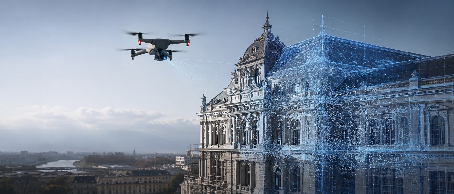
Drone 3D Building Scanning in Sibiu
Turn a building or structure into an accurate 3D model, ready for reconstruction.
Drone 3D building scanning captures a structured grid of overlapping aerial photos around and above a building or structure, then processes them into a textured 3D model or point cloud. In Sibiu and within 150 km, we deliver models ready for reconstruction, restoration and CAD/BIM work, as an EASA-licensed and insured operator.
- Best for
- Architects and restoration teams
- Heritage projects
- Developers
- Structural engineers
- What you get
- Textured 3D model / point cloud
- High-resolution source photos
- CAD/BIM-ready output
- Typical deliverables
- 3D mesh/point cloud (OBJ, PLY, FBX)
- High-resolution source photography
- Service area
- Sibiu and within 150 km
- How to book
- Request a custom quote on WhatsApp or via the contact form.
Aerial photogrammetry turns a building or structure into an accurate 3D model built for reconstruction, restoration and as-built documentation. We fly a structured grid of overlapping photos around and above the subject, then process it into a textured 3D mesh or point cloud ready for architects, engineers and heritage specialists to work from. This captures façades, rooflines and hard-to-reach detail that ground-based photos or manual measurement can miss, in a fraction of the time a full manual survey takes. The output integrates directly into CAD, BIM and 3D modelling software, giving reconstruction teams a precise reference instead of guesswork. We plan every flight around the structure's geometry and site access, and operate as an EASA-licensed, insured drone operator across Sibiu and within 150 km. It suits pre-restoration surveys, heritage documentation and any project where an accurate as-built model saves time compared to manual measurement on site.
What we film
- Full structured photo grid around and above the building
- Façade, roofline and detail close-ups
- Overlapping imagery for accurate 3D reconstruction
- Coverage of hard-to-reach or elevated features
Deliverables
- Textured 3D mesh / point cloud (OBJ, PLY, FBX)
- High-resolution source photography
- Model ready for import into CAD/BIM software
- Optional orthophoto/plan view on request
How it works
- 01Brief and reconstruction goal
- 02Site, access and airspace check
- 03Structured aerial photo capture
- 043D model processing and delivery
Frequently asked questions
Related services
Want this video to bring in leads too? Ask about promotion
Ready to film?
Tell us about your project and we'll send a custom quote. No fixed packages, no guesswork.